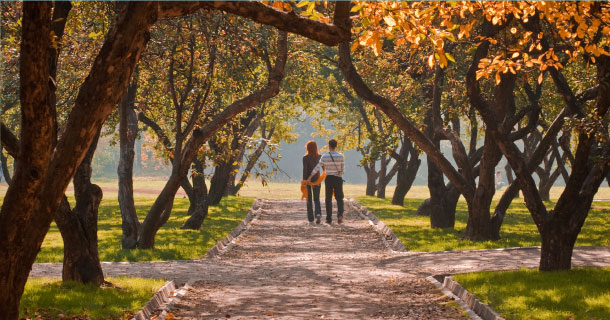
Abundant natural areas make our seven-county region a more desirable place to live and work, and without green spaces, our economic competitiveness would suffer.
Parks and open space were central to the 1909 Plan of Chicago. Daniel Burnham helped to preserve open corridors of land—our parks, forest preserves, and the lakefront—contributing immeasurably to the welfare of our region and its residents.
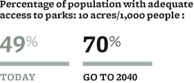
Yet Burnham's network of open space remains a work in progress. Less than half of our region's residents have adequate parks nearby. Despite well-documented benefits like flood protection and biodiversity, much of our region's natural open space remains unprotected.
The region's network of parks and open space is our "green" infrastructure—no less essential to prosperity and livability than any other infrastructure. But as with systems for transportation, water treatment, and other needs, our green infrastructure must be managed, restored, and expanded.
Through coordinated investments, we should preserve a network of land and water corridors by increasing current preserves and creating new ones. The region should provide functional connections (known as greenways) between parks and preserves to support recreation and ecosystems.
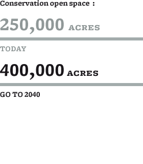
The GO TO 2040 plan recommends that the region make significant, criteria-based investments in parks and open space—providing more parks in developed areas, preserving the region's most important natural areas, and providing functional connections between parks and preserves by using the green infrastructure network as a design concept.
Our region has expanded over the last 100 years, and the corridors of open space Burnham envisioned must expand as well. We owe it to future generations and to ourselves.
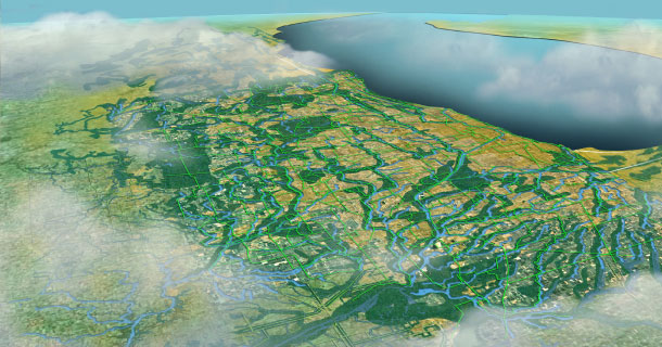
GO TO 2040 proposes a green infrastructure network that follows waterway corridors, expands existing preserves, and creates new preserves in the region.