(Please note that the second installment in this two-part series was posted on October 27, 2011.)
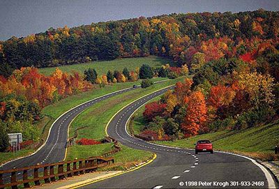
GO TO 2040 calls for a small number of major capital projects to provide substantial new capacity to the transportation system over the next three decades. CMAP analysis found the Central Lake County Corridor, which would extend IL-53 north and construct a bypass of IL-120, to have the greatest congestion reduction benefits of all major capital projects considered for inclusion in GO TO 2040. In order to fit the community character and reduce environmental impacts, GO TO 2040 recommends a "modern boulevard" for the corridor.
Despite their name, modern boulevards are firmly rooted in the past, echoing some of the earliest designs for highway facilities in the U.S. Drawing on 19th Century parkways constructed as recreational motoring facilities, early 20th Century planners designed grade-separated, limited-access highways. These innovations helped reduce traffic conflicts and maintain consistent travel speeds. Unlike today's interstates or expressways, early facilities had fewer lanes, lower design speeds, and simpler interchanges. In some cases these facilities were designed to be multimodal and with complementary land use planning. However, this approach was largely discarded by the mid-20th Century in favor of higher-speed, more complex facilities funded by new federal gas taxes and during the Interstate era. Recent years have seen a renewed interest in more context-sensitive approaches, and transportation officials have increasingly turned to design approaches such as boulevards and roundabouts to meet mobility, safety, and aesthetical goals.
In part because of their roots in recreational travel, many early examples of limited-access highways demonstrate strong aesthetic details, such as rustic bridges or Art Deco detailing, or by preserving scenic vistas and following the natural contours of the land. Today, several of these facilities have been recognized as National Scenic Byways and are listed on the National Register of Historic Places. To help visualize what a modern boulevard could look like in Lake County, this Policy Update profiles three historic parkways from the East Coast. The second installment will review contemporary examples of context-sensitive parkway-type facilities in the U.S.
To learn more about current planning efforts on the Central Lake County Corridor, the Illinois Tollway has posted materials for the ongoing Illinois 53 Blue Ribbon Advisory Council to its website. CMAP is participating in the Council's ongoing work, and executive director Randy Blankenhorn serves as the Design & Land Use committee chair for the group.
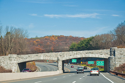
Merritt Parkway, Connecticut
Opened: 1938
The Merritt Parkway parallels the old Boston Post Road, a historic arterial connecting New York City and Boston along the Connecticut shoreline. The Merritt Parkway has two lanes in each direction and is known for passing through scenic forests and its unique decorative bridges. During project development, local residents feared a new road would bring in an influx of New Yorkers, so the Parkway was constructed to be limited access, smaller in scope, and harmonious with the landscape.
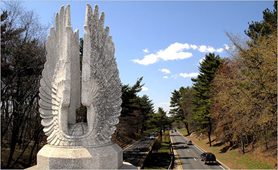
Source: Thomas McDonald for the New York Times
Source: Townsend P. Dickinson/The Image Works, Forbes.com
Source: Los Angeles Times
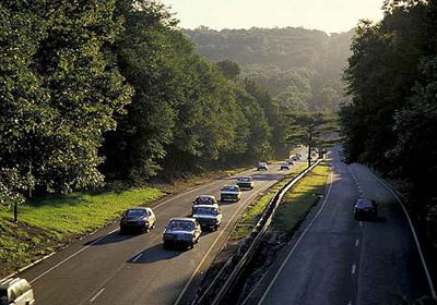
George Washington Memorial Parkway, Virginia
Opened: 1932
The George Washington Memorial Parkway connects historic sites in northern Virginia, including Mount Vernon, Alexandria, and Arlington. The route follows the course of the Potomac River and the road is screened from adjacent development by thick woods. The first section of the motorway was opened in 1932, and today the National Park Service operates the facility.
Source: Thingstodo.com
Source: America's Byways
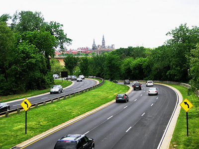
Source: Leo Boudreau, Flickr.com
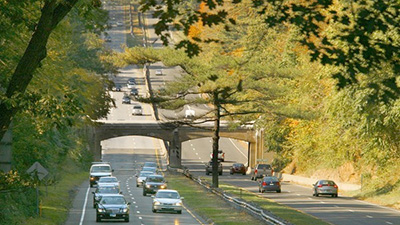
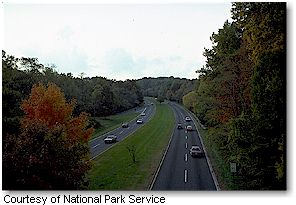
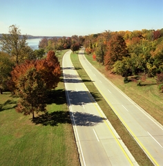
Taconic State Parkway, New York
Opened: 1932
The Taconic State Parkway follows a winding route through a forested, hilly region east of the Hudson River in upstate New York. It was constructed in phases over several decades, and today measures some 104 miles. The Parkway's alignment was designed to maximize scenic views of neighboring mountains, and the road features rustic bridges and rest areas designed to blend in with their surroundings.
Source: Phillip Capper, Flickr.com

Source: Librado Romero for the New York Times
Source: Peter Krogh