 On June 24, 2019, the Maine-Northfield Unincorporated Area Plan was accepted by the Cook County Department of Planning and Development.
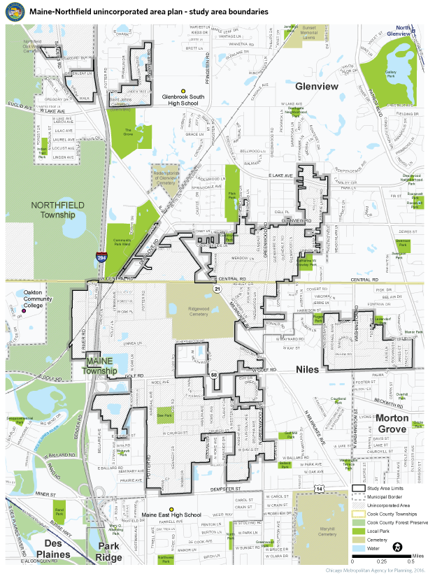
In terms of project background, throughout Cook County there are several areas of land that are developed but have never been annexed to a municipality. These areas have been studied in the past by the Civic Federation and the Cook County Unincorporated Task Force. However, Maine and Northfield Townships stand out as especially densely populated areas that warrant further study into ways to improve quality of life for its diverse residents. The study area for this project is called "Maine-Northfield," reflecting portions of both unincorporated Maine and Northfield Townships. This area has never been the focus of a long-range comprehensive plan.
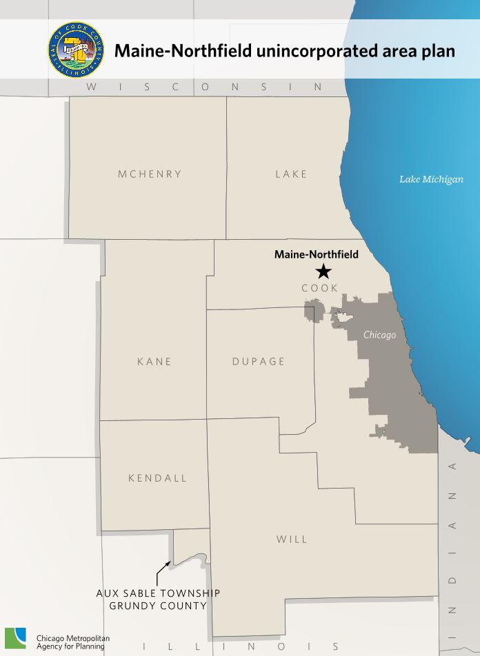
The center of Maine-Northfield is approximately 17 miles northwest of downtown Chicago and is bordered by Des Plaines, Glenview, Morton Grove, Niles, and Park Ridge. The study area does not include all of the unincorporated parcels in Maine and Northfield Townships, but it does include the most densely populated developments, as well as the locations of infrastructure concerns that have prevented large-scale annexation. The study area is made up of three sections: a large, mostly contiguous area stretching from Dempster Street on the south to past Lake Avenue on the north; a separate area north of Golf Road roughly between Harrison Street, Crescent Drive, and Stacy Court, with Washington Street bisecting; and three separate residential areas in close proximity near Milwaukee Avenue, Sanders Road, Lake Avenue, and Landwehr Road.
CMAP partnered with Cook County to develop the Maine-Northfield Unincorporated Area Plan. The plan evaluates the community's challenges and opportunities and has identifies viable strategies to help guide future growth and development. The plan addresses land use, stormwater, transportation, housing, and coordination and capacity. In addition, the plan discusses the area's relationship with neighboring incorporated communities. The plan includes a fiscal impact analysis that estimates the revenues and costs of potential annexation of the study area.
The three-phase planning process was completed over approximately three years. First, the planning team analyzed existing conditions using information and public input. Next, the team developed a vision for the area based on input gathered during the community visioning workshop. Finally, CMAP created recommendations and implementation strategies in the final Maine-Northfield Unincorporated Areas Plan.