This is the last in a series of three Policy Updates on the structure of transportation funding programs in Illinois, as well as the governance of our state and local highway system. The first post provided background information on the local motor fuel tax (MFT) allotments shared by the state with counties, municipalities, and townships, in addition to other transportation revenue-sharing programs. The second post evaluated the effectiveness of the Illinois local MFT sharing program. This post explores the relationship between municipalities and townships in the local highway system and its funding.
The local road system in Illinois is organized hierarchically. County highways provide connectivity and collect traffic from local roads to serve travel at higher speeds and volumes. Township and municipal highways, on the other hand, generally provide access to individual properties and serve travel at lower speeds and volumes. The key difference between municipal and township highway networks is where they provide local access -- in general, municipal roads serve urban areas and township roads serve rural areas. In more urbanized areas like the CMAP region, though, this is not always the case. While local MFT allotment criteria are uniform across the state, the road systems they serve are not. This post analyzes the relationship between township and municipal roads, including MFT funding distributions and the organization of the local road system. New approaches to MFT disbursement could make transportation revenue sharing in the state more efficient.
Background
Each unit of local government is responsible for roads under its jurisdiction. Typically, counties maintain arterial roads, municipalities maintain local roads, and townships maintain a range of local and rural roads. This analysis relies on 2012
Illinois Roadway Information System (IRIS) data. While municipalities receive MFT disbursements based on population, the state distributes MFT revenues to townships based on road mileage.
The following table demonstrates an inverse relationship between lane mileage and traffic levels for the three local road systems in Illinois. Townships maintain many miles of lightly traveled roads, which is consistent with the large, rural areas they tend to serve. In contrast, there are far fewer county and municipal roads, but these roads are more heavily traveled than township roads. There are more than twice as many municipal roads than county roads, indicating the role of municipal roads in providing local access to properties. Higher traffic levels and lower mileage on county roads suggest their importance as arterial facilities.
Lane miles and average annual daily traffic for local road systems in Illinois| | Lane Miles | Average Annual Daily Traffic (AADT) |
| County | 33,800 | 5,100 |
| Municipality | 80,900 | 4,200 |
| Township | 135,200 | 300 |
Patchwork of Township Highways
While the road system follows a hierarchy, there are locations in which the hierarchy does not fit the local context. Suburbanization changes the nature of township road systems from a rural to municipal context, but in many cases the jurisdictional organization has not evolved accordingly. Often, not all land in a suburbanizing township is incorporated, and development may occur in unincorporated areas. In other circumstances, a municipality may have incorporated township land, but portions of the road network remain within a township's jurisdiction. Either way, the result is a patchwork of township highways within a metropolitan context. Yet these township highways receive local MFT disbursements based on lane miles that do not reflect their higher traffic, which clearly occurs in a metropolitan and not a rural context.
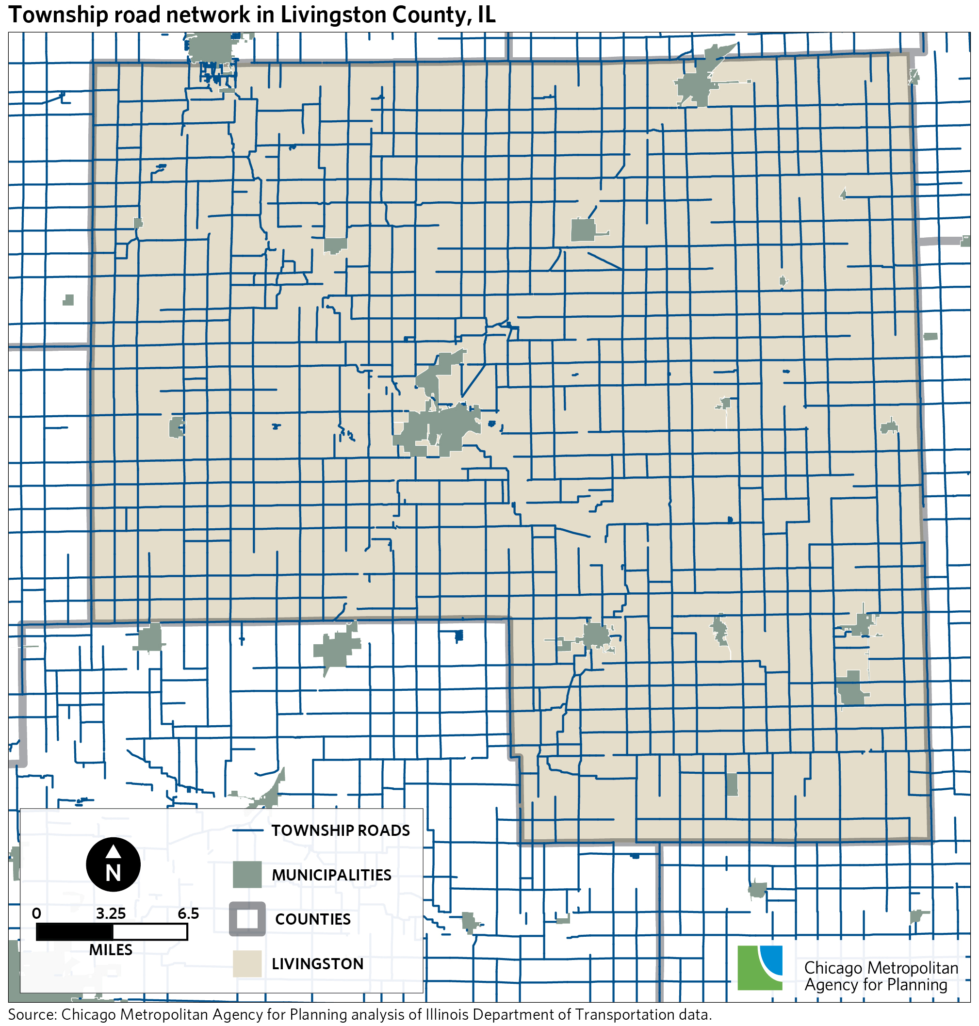
This phenomenon is best illustrated through a series of maps. The first shows the township road network in Livingston County, a largely rural county of about 40,000 residents located 100 miles southwest of Chicago. The township road network generally follows a one-mile grid pattern across the county's unincorporated areas.
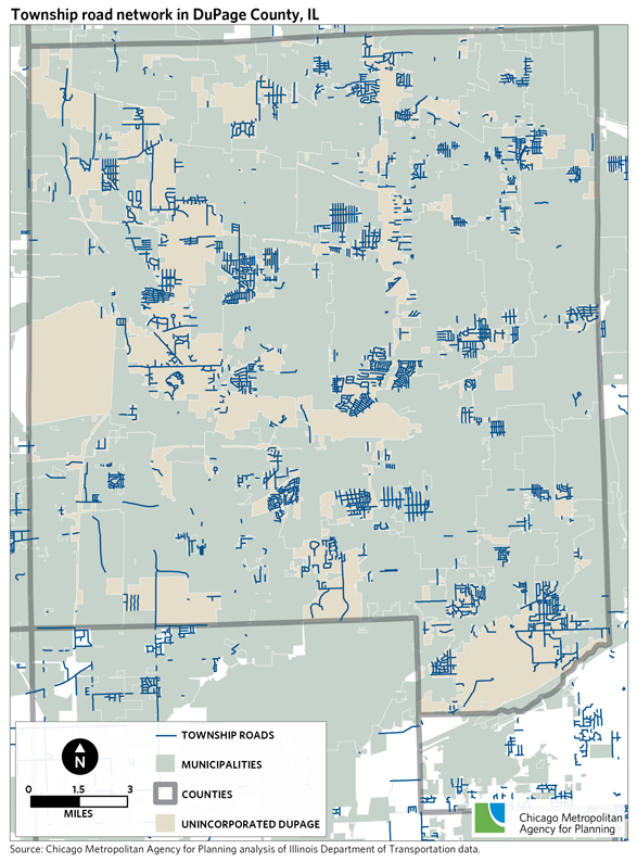
Click for larger image.The next map shows DuPage County, a large suburban county of over 900,000 residents located in the center of the CMAP region. DuPage County has not been rural for several decades, and because the majority of its land is incorporated, the townships have disjointed road networks in the few remaining patches of unincorporated areas. In contrast to Livingston County, the township roads in DuPage County are not part of a spread out, regular rural grid. Rather, they are small, dense networks that often serve individual subdivisions.
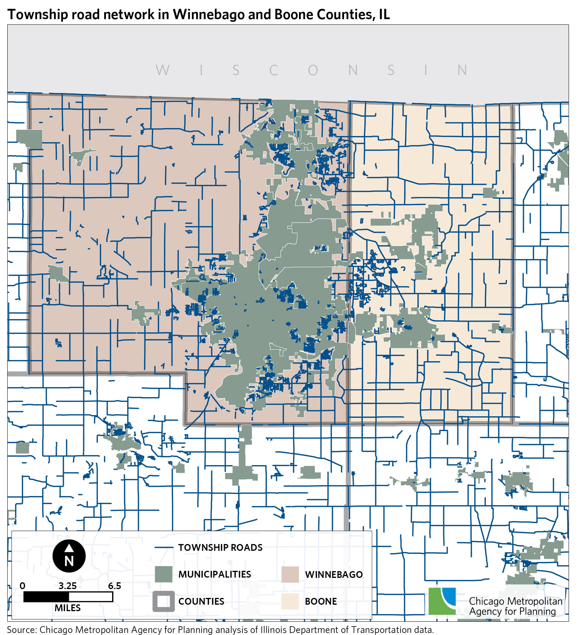
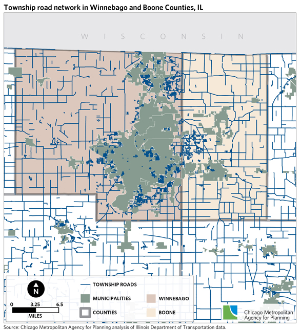
Click for larger image.This pattern holds for other counties in the CMAP region and metropolitan areas throughout Illinois, such as Bloomington-Normal, Metro East (outside St. Louis), Peoria, and Springfield. As an example, the next map shows Boone and Winnebago Counties in the Rockford area. There, dense networks of township roads serve developments concentrated in the unincorporated areas between and at the fringes of municipalities; in more rural areas of the two counties, the township road network takes on more of a dispersed grid pattern.
Click for larger image.Discussion
Township road systems are not uniform, as illustrated by the preceding maps. What may be an efficient funding and governance structure in one area of Illinois may not apply to the local context in another area of the state. And yet the local MFT allotment criteria are applied rigidly across the state. Under current criteria, some townships receive very small local MFT allotments while others receive none at all. Illinois Department of Transportation
data from 2013 shows that 26 townships received fewer than $10,000 in local MFT allotments, and one township received less than $1,000.
Comparing local MFT allotment criteria to the diversity of local road systems may enhance the efficiency of how the MFT is shared with local governments. For example, one potential new approach to MFT disbursement could treat townships in urbanized areas as if they were municipalities, allotting local MFT funds by population. Their roads, while relatively small in extent, serve more densely populated areas. Alternatively, township roads in largely urbanized townships could be maintained by adjacent municipalities through formal agreements or, in some areas, by annexation of unincorporated land by municipalities. Annexation may provide other cost efficiencies in the delivery of public safety, code enforcement, and other local services. In fact, the Cook County Unincorporated Task Force
recommended in April 2012 that municipalities be encouraged to annex the remaining small, unincorporated parcels of land in the county, citing cost reductions and greater local control as key benefits. CMAP supports strategically directing resources through performance-based funding, as well as efforts to coordinate and consolidate local services.